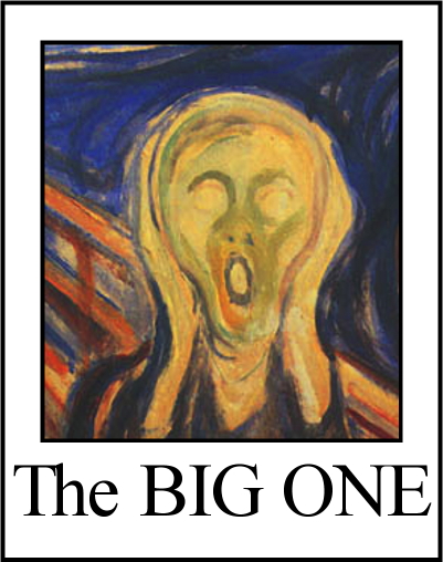
Home Information Pictures Maps Google Map Visit the fault Earthquakes Be Prepared ShakeOut! Big One
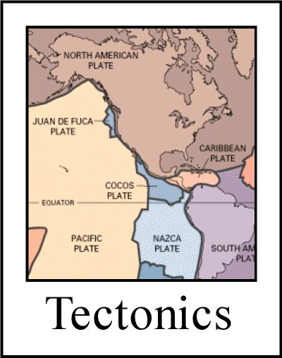
Tectonics Volcanoes Tsunamis California geology History Myths Organizations Links About Research
![]()
The San Andreas fault's nick name is "SAF".
Did you feel it?
Modified Mercalli scale of ground shaking
|
|
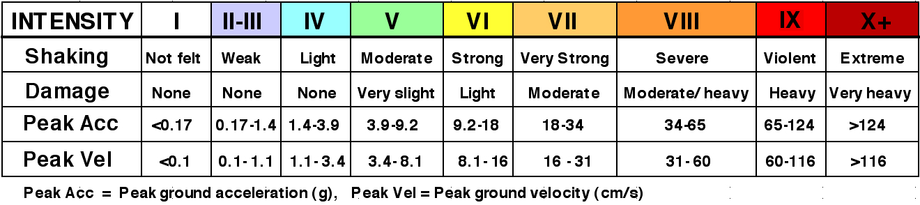
The MM is useful for two reasons. (1) it tells geologists how the earthquake affected ground motion in various surface types: soil, bed rock, fill, etc. (2) It allows geologists to use eye witness accounts of historic earthquakes to reconstruct the approximate magnitude of a shaker that occurred before seismographs were invented. In general, shaking decreases with increasing distance from the epicenter. But the ground does not necessarily shake hardest at the epicenter. Seismic waves can be amplified or damped depending on soil and rock type. The most violent shaking usually takes places in regions where liquefaction occurs. Liquefaction is an effect where normally solid soil is shaken and becomes somewhat fluid, like pudding. Damage to structures occurs at liquefaction sites because the foundation is no longer on solid ground. |
 An earthquake's magnitude tells how much energy was released in the quake but not how hard the ground shook. After all, even when the Big One hits California, people in New York won't feel it and those in Reno will only feel mild shaking. That's where the Modified Mercalli Intensity Scale (MM) comes in. It is a semi-quantitative estimate of the intensity of the shaking based on first-person accounts. Maps based on the Mercalli Scale are called "Shake Maps". Here is one.
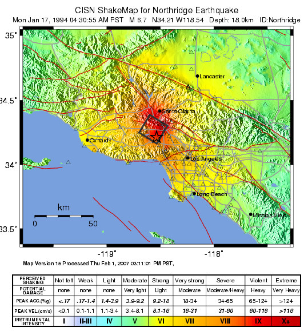
USGS "Did you feel it?" (DYFI) website
USGS Scientific background on Shake Maps
USGS Shake Map for the 1906 San Francisco earthquake
USGS Shake Map for the 1989 Loma Prieta earthquake
USGS Shake Map for the 1994 Northridge earthquake
USGS Shake Map for the 2010 El Mayor - Cucapah earthquake
California Integrated Seismic Network (CISN) "scenario" shake maps.
California Integrated Seismic Network (CISN) home page
Modified Mercalli Intensity Scale
I: Not felt, except rarely under especially favorable circumstances.
II: Felt indoors only by a few persons, especially on upper floors of buildings. Delicately suspended objects may swing.
III: Felt indoors by several persons; motion usually rapid vibration, like that of a passing truck. Sometimes not recognized to be an earthquake at first.
IV: Felt indoors by may, outdoors by few. Awakens some sleeping persons. Dishes, windows and doors rattle, walls creak. Standing cars rocked noticeably. Hanging objects swing.
V: Felt indoors by practically all, outdoors by many; outdoors direction estimated. Awakens many sleeping persons. Causes a few persons to run outdoors. Breaks some dishes, and cracks a few windows and plaster walls. Overturns vases and other small, unstable objects. Hanging objects and doors swing considerably. Some liquids spilled from full open containers. Pictures on walls knocked out of plumb.
VI: Felt by all. Causes general excitement; many frightened and run outdoors. Some heavy furniture moved. A few instances of fallen plaster and damaged chimneys, but damage slight in poorly built structures. Small bells ring. Breaks a considerable amount of glassware and windows. Pictures, knickknacks, and books fall from walls and shelves. Some furniture overturned.
VII: Frightens all persons; some find it difficult to stand; noticed by persons driving autos. Trees and bushes moderately shaken; waves noticed on ponds and lakes; water turbid from stirred up mud; some stream banks collapse. Large church bells ring. Damage negligible in well designed and constructed structures, slight to moderate in well-built ordinary structures, and considerable in poorly built or designed structures; weak chimneys broken at roof-line, sometimes damaging roofs.
VIII: Fright general, approaching panic. Damage slight in structures especially designed to withstand earthquakes; considerable damage to ordinary substantial buildings, with partial collapse; great in poorly built structures. Panel walls thrown out of frame structures. Fall of chimneys, factory stacks, columns, monuments, walls. Heavy furniture overturned or conspicuously moved. Sand and mud ejected in small amounts. Noticeable changes in flow of wells and springs. Persons driving automobiles disturbed.
IX: General panic. Damage considerable in (masonry) structures built especially to withstand earthquakes; well-designed frame structures thrown out of plumb or shifted off of foundations; great damage in substantial (masonry) buildings, with partial collapse. Buildings shifted off foundations. Ground cracked conspicuously. Some underground pipes broken.
X: Severely damages some well-built wooden structures and bridges severely damaged; destroys some. Destroys most masonry and frame structures and their foundations. Well-built brick walls cracked. Ground badly cracked. Landslides considerable from river banks and steep slopes. Shifted sand and mud on beaches and flat land. Water splashed over banks of canals, rivers, and lakes. Underground pipes broken. Open cracks and broad wavy folds in cement pavement and asphalt surfaces. Railroad rails bent slightly.
XI: Disturbances in ground many and widespread, varying with ground material. Broad fissures in ground. Earth slumps and landslides in soft wet ground. Sand and mud-charged water ejected from ground. Severely damages wood-frame structures; few, if any, (masonry) structures remain standing. Bridges destroyed. Underground pipelines completely out of service. Rails bent greatly.
XII: Damage total. Practically all works of construction are damaged greatly or destroyed. Numerous landslides and rockfalls; slumping of river banks. Waves seen on ground surface; lines of sight and level are distorted. Objects thrown upward into air.
NOTE: SanAndreasFault.org has been unable to locate the full version of Mercalli Scale. If you know where it can be found, please contact us at the link below. Thank you.
Please help us make this site better. Email us suggestions, pictures, links, etc. here.