Home Information Pictures Google Map Visit the fault Earthquakes Be prepared ShakeOut! Feel it? Big One
Tectonics Volcanoes Tsunamis California geology History Myths Organizations Links About Research
![]()
The San Andreas fault's nick name is "SAF".
Maps
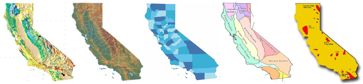
California has many faces.
|
Road Maps: These are the most familiar kind of map, the kind that you have in your car. They are base maps with cities, counties, state boundaries, cities and roads. Topographic Maps: Base maps with elevation contours. Geologic Maps: Base maps with surface rock types, elevation contours, faults, rivers, lakes, land form symbols, etc. How to read a geologic map |
Specialty Maps: Base maps with various graphical information such as earthquake locations, faults, terrain, vegetation, elevation, temperature, population density, clouds, weather systems, range of flora and fauna, etc. Maps are usually presented as flat, like a sheet of paper. But since the Earth is spherical, flat representations of any part of it are inevitably somewhat distorted. The larger the area involved, the more the distortion, which is a projection effect. There are many map projections. Here is a good place to start to understand them. People who make maps are called cartographers. |
Interactive tectonic-related maps
Google Map showing the main trace of the SAFNew (2010) CGS Fault Activity Map of California
California geologic maps from Google Earth Library (kml files)
Major faults in southern California
Faults in the Los Angeles area (and links to fault maps in other California cities)
Quaternary Fault and Fold Database of the United States
Recent earthquakes in California, the USD and world
UCSD Broadband Seismic Network map of recent southern California earthquakes
USGS liquefaction susceptibility map of the San Francisco area
CGS Interactive earthquake probability map
California 7.5' topo quads (PDFs) showing faults based on the Alquist-Priolo maps
General interactive maps
Google MapsNew (2010) CGS Geological Map of California
Bing Maps. Check out "Bird's eye" under "Aerial" in many close-up locations.
Microsoft Research Maps (formerly USGS Microsoft TerraServer
US National Atlas
US National Atlas with many selectable overlay features
US Census Bureau maps
USGS Earth Explorer
Woods Hole Oceanographic Institute Mapit site
Static Maps
California geologic map (PDF)California quad map (PDF)
Index map for Dibblee geologic maps
USGS USGS map store for California
California Geomorphic Provinces
California geothermal map (PDF)
California seismic hazard map
USGS California volcanic hazard map
Various CGS maps of California
California State and National Park maps, also by region (PDFs)
CSUH's on-line maps of California
Wikipedia California Atlas page
USGS earthquake hazard program
Chubb Custom Cartography fault and tsunami maps
Please help us make this site better. Email us suggestions, pictures, links, etc. here.