Home Information Pictures Maps Google Map Visit the fault Earthquakes Be Prepared ShakeOut! Feel it?
Big One Volcanoes Tsunamis California geology History Myths Organizations Links About Research
![]()
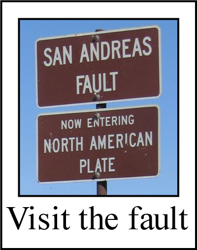
The San Andreas fault's nick name is "SAF".
Tectonics

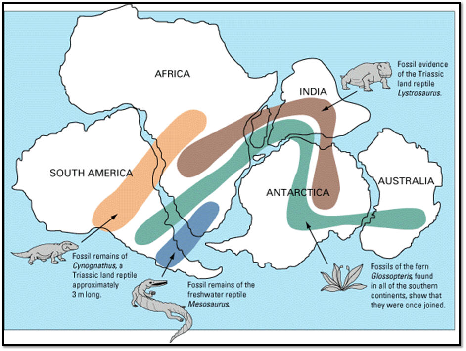
Tectonic Plates, fossil correlations in Pangea and notional diagram of plate motions
|
|
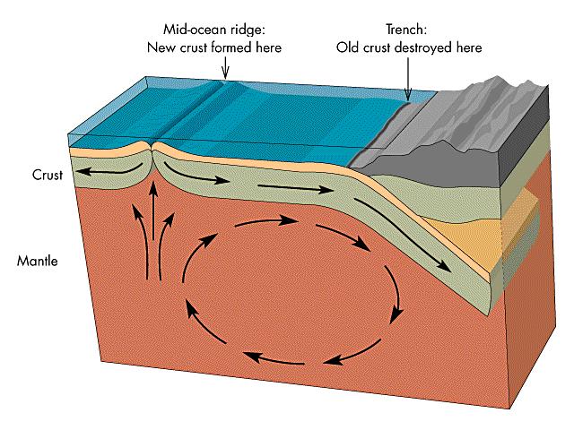
If new crust is created, then it must be destroyed some where, otherwise the Earth would grow, which it cannot. Crust is consumed in subduction zones. When two plate move together, one of them must slide under the other one. This is called subduction. When an oceanic plate and a continental plate meet, the denser oceanic plate subducts under the less dense continental plate. The subducting plate slips down into the mantle where it is heated, melts and is recycled. Thus spreading centers and subduction zones act like a conveyor belt, manufacturing crust at one end and consuming it at the other. The deepest parts of the ocean occur in trenches along subduction zones. The largest earthquakes are associated with subduction zones. Because of subduction, the sea floor is relatively young, no where more than about 200 million years old. The continents, on the other hand, are much older. They can last a very long time while spreading and subduction take place. Some continental rocks are as much as 4 billion years old. Because California is largely the product of tectonic activity during the last 230 million years, most of its rocks are relatively young, those older than 230 million years being rare. In California we have the Cascadia subduction zone. It extends from offshore Cape Mendocino northward to Vancouver, and is responsible for volcanoes of the Cascades Range, including Mt. Shasta and Lassen Peak. When two continents collide, it gets messy. Instead of subducting, some of the sea floor gets scraped off by the over-riding continent and remains stuck, usually mixed with continental sediments carried into the ocean by rivers. Such pieces of sea floor in California are known as the Franciscan Formation, or melange. Much of the west coast of California between San Luis Obispo and Humboldt counties are composed of Franciscan rocks. Complete sections of the oceanic crust that have been uplifted to the surface are called ophiolites. Ophiolites are produced at spreading centers. California's Josephine, Elder Creek, Jarbo Gap, Coast Range and Cuesta Ridge ophiolites are good examples. |
More About Plate Tectonics
Plate tectonics videos
USGS This Dynamic Earth
CSU Pomona tectonics website
SDSU tectonics website
U. Maryland tectonics website
Dispersal of Gondwanaland
Please help us make this site better. Email us suggestions, pictures, links, etc. here.