Low altitude double pass imaging flight over the SAF between I-5 (Tejon Pass) and CA-198 (Middle Mountain)
David K. Lynch (USGS), Kenneth W. Hudnut (USGS)
On 5 Jan 2011 we flew a nadir imaging flight from I-5 to CA-198 and back. The northtbound leg was at 500 ft AGL nominal and the return leg was at 1500 ft AGL nominal. Significant excursions from the planned altitude and flight track occurred because of strong cross winds and low level clouds (ground fog). As a result, roughly 10% of the images either missed the SAF or were obscured by clouds. After completing the flight and performing a quick-look validation, it was clear that the double pass flights produce valuable complimentary (~150 and ~450 m AGL) data sets, and made efficient use of expensive flight hours. Total cost: $1920. The EXIF portion of each image contains GPS information about the camera's location. Shortly after the fight, all images were made publicly available on this website.
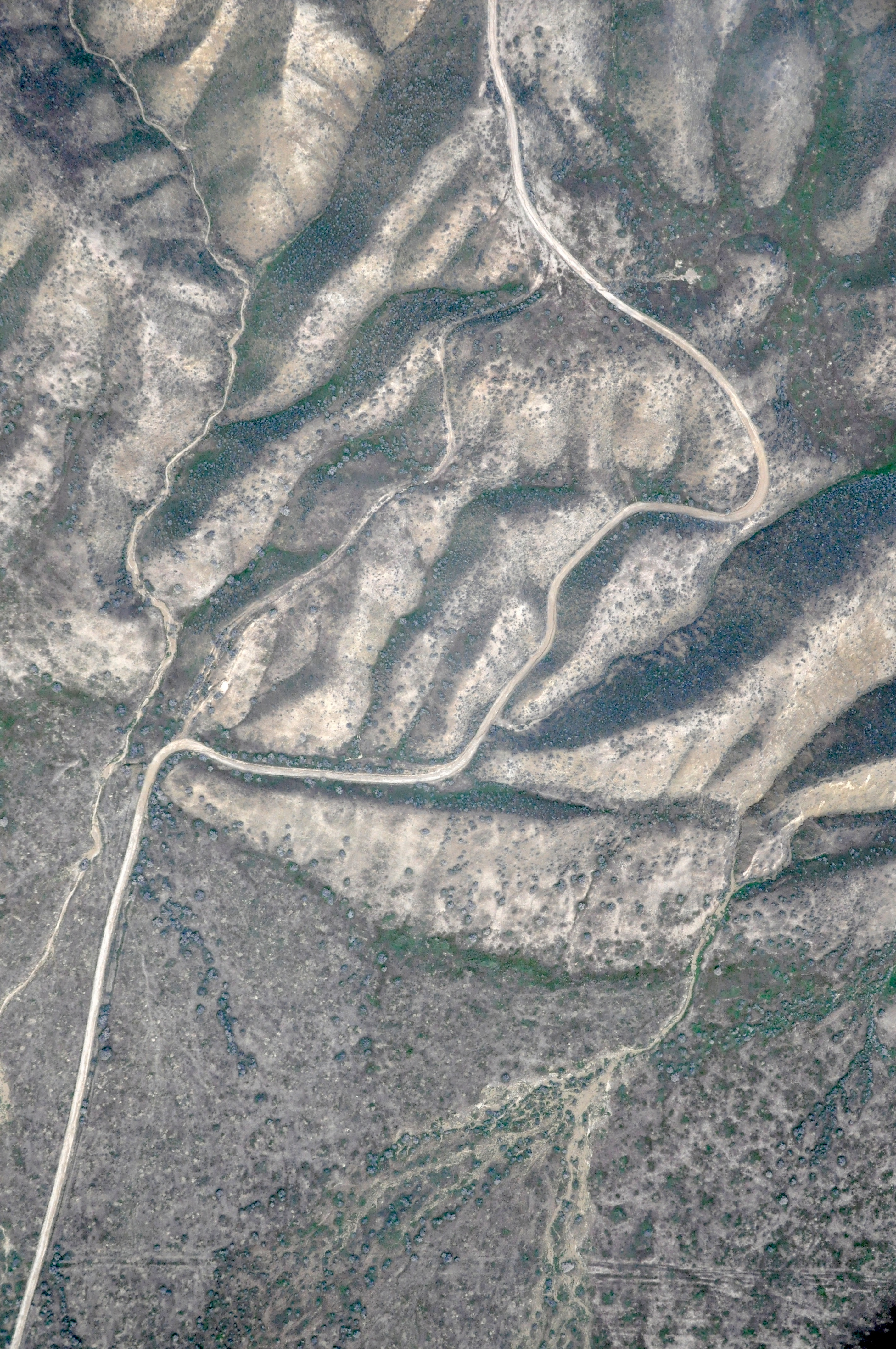
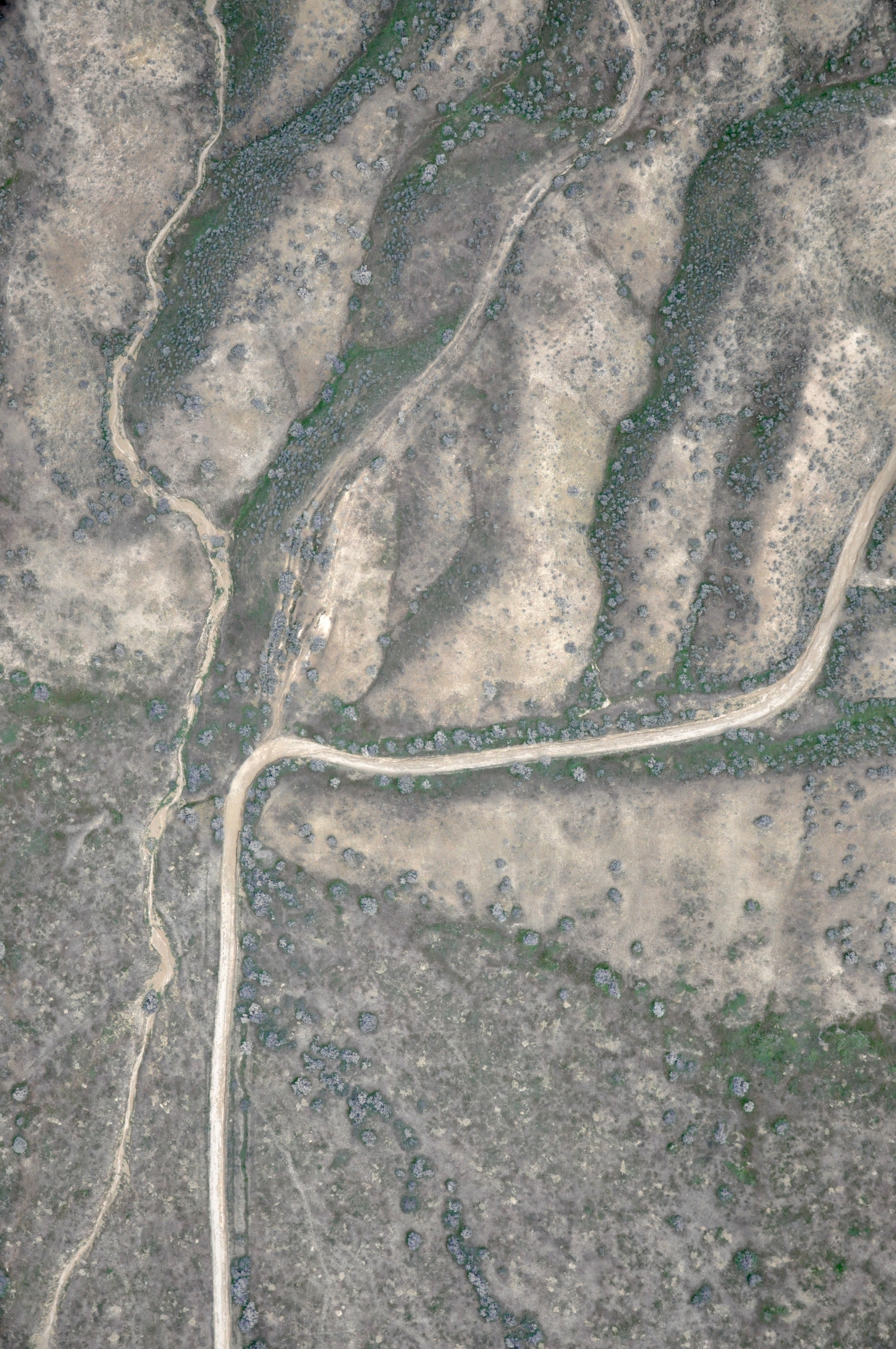
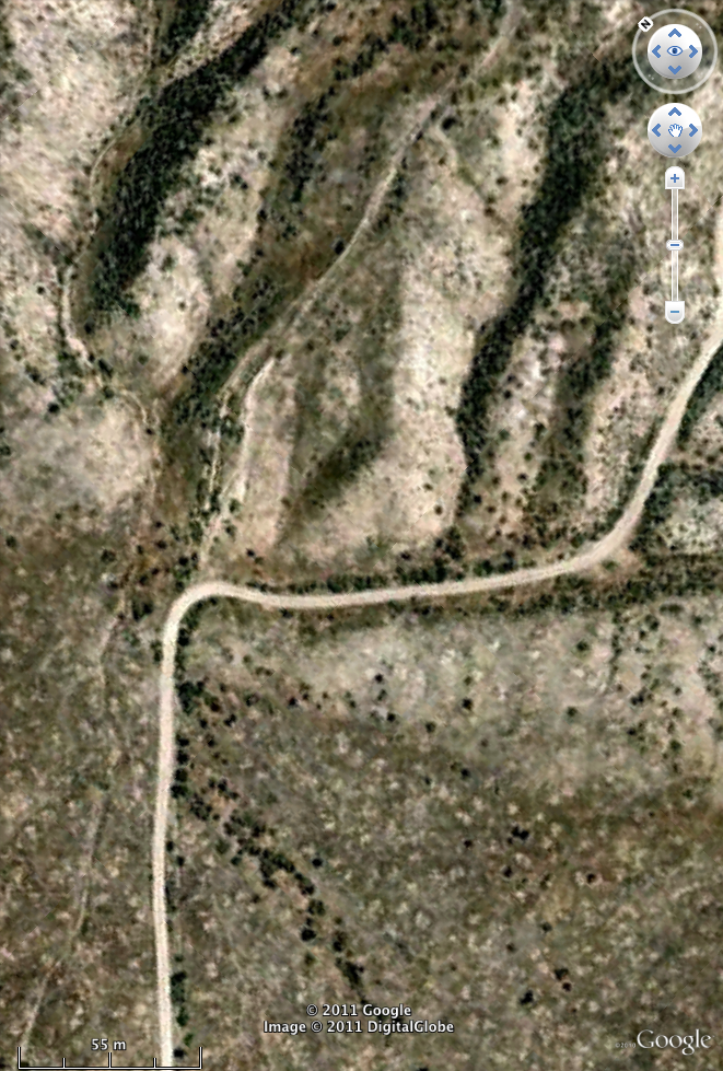
Clickable pictures. Left: DSC_2589_AR.jpg (~1500 ft AGL). Center: Small portion of DSC_9603.jpg (~500 ft AGL). Right: Google Earth image of same region.
Picasa Web Albums
I-5 (Gorman) to southern Carrizo Plain (latitude 34.816583 to 35.054300) 9148.JPG to 9635.JPG
Southern Carrizo Plain to mid Carrizo Plain (latitude 35.055080 to 35.261403) 9636.JPG to 9999.JPG
Mid Carrizo Plain to just north of Parkfield (latitude 35.261715 to 35.933475) 1000.JPG to 1552.JPG
Just north of Parkfield to Middle Mountain south of CA-198 (latitude 35.933995 to 36.163720) 1553.JPG to 2551.JPG
Middle Mountain to CA-198, ascend, then south to southern Carrizo Plain (latitude 36.201075 to 36.192480) 2552.JPG to 3196.JPG
Southern Carrizo Plain to Frazier Park (latitude 35.064715 to 34.819203) 2552.JPG to 3196.JPG
All 4048 JPG Photographs in this survey are public domain and carry no copyright. Photographs may be freely downloaded by anyone and used for any purpose. We ask that people using the data include the acknowledgment "USGS photograph by David K. Lynch and Kenneth W. Hudnut" and cite the SRL paper (above).
This work sponsored in part by the Southern California Earthquake Center (SCEC) under Research Award 09084 and USC PO-145212.