Low altitude double pass imaging flight over the SAF and Banning fault between I-15 (Cajon Pass) and the Salton Sea (Bombay Beach)
David K. Lynch (USGS) Kenneth W. Hudnut (USGS) John R. Bayless (First Point Scientific, Inc.)
On 28 and 29 July 2011 we flew a nadir imaging flight from I-15 to the Salton Sea and back. The southeast bound leg was at 700 ft AGL nominal and the return leg was at 1400 ft AGL nominal. We flew higher than the nominal elevation between Burro Flats and Whitewater Canyon (Bonnie Bell) to encompass the range front excursions of the Banning Fault. After completing the flight and performing a quick-look validation, it was clear that the double pass flights produced valuable complimentary data sets, and made efficient use of expensive flight hours. Total cost: $3800. The EXIF portion of each image contains GPS information about the camera's location. Shortly after the fight, all images were made publicly available on this website.

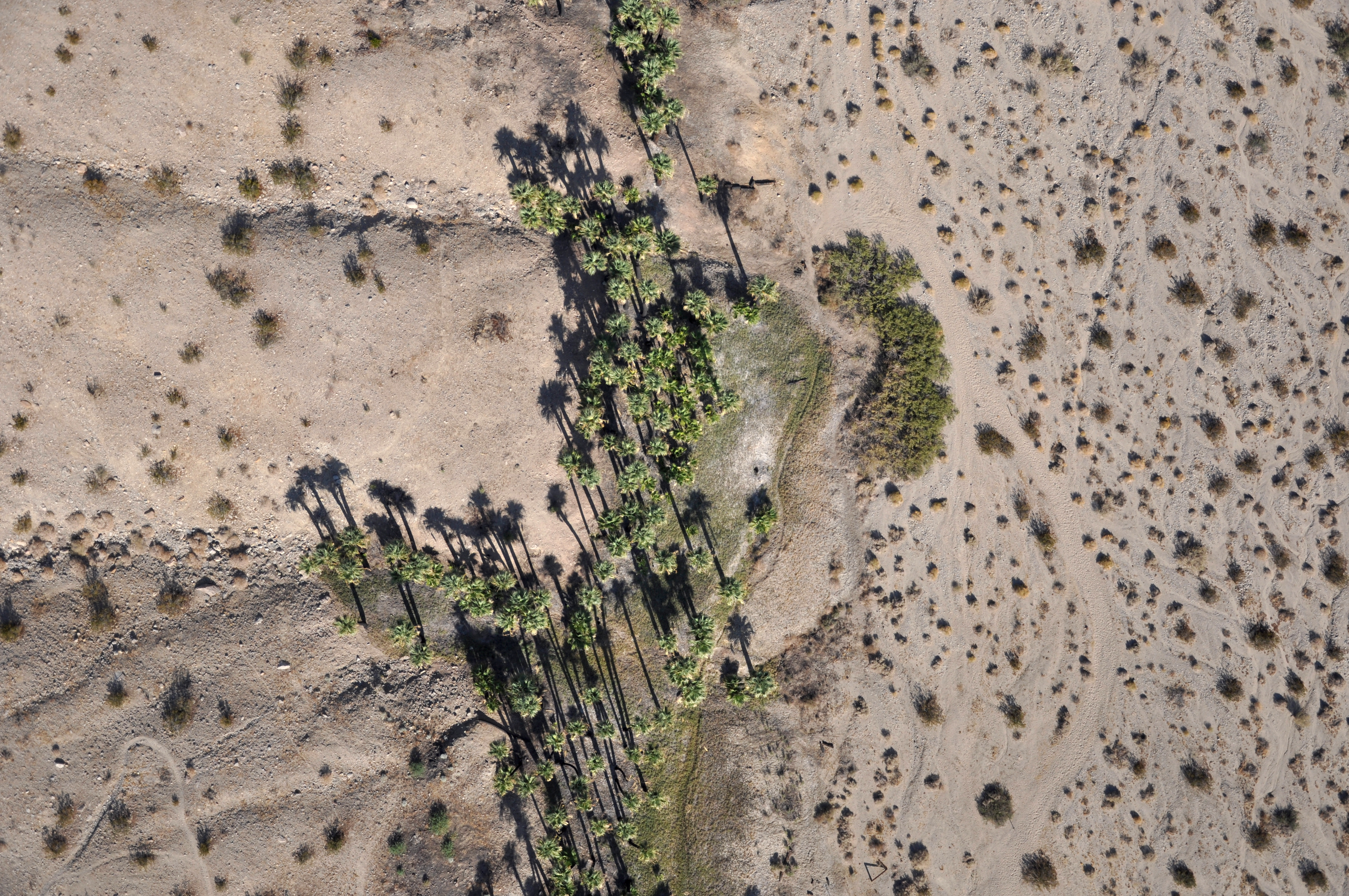
Clickable pictures. Left: Willis Palms (~1400 ft AGL). Right: Willis Palms (~700 ft AGL).
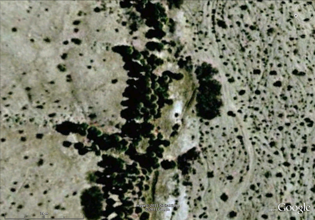
Center: Google Earth image of same region as Willis Palms above right.
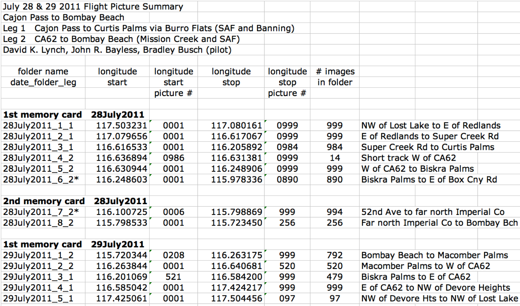
Owing to the large number of large photographs, we have not yet (and may never) put them into PICASA web albums. We have however grouped the photos and indicated the range of longitudes and rough geographic location in a table in JPG photographs. The table is shown below.
Due to space limitations of our webhoster, we are not able to put all the pictures on this site at this time. We are presently working to resolve this situation. If you have immediate need for some of the photos, please contact us (Lynch or Hudnut) using the email links at the top of this page.
All 9022 JPG Photographs in this survey are public domain and carry no copyright. Photographs may be freely downloaded by anyone and used for any purpose. We ask that people using the data include the acknowledgment "USGS photograph by David K. Lynch and Kenneth W. Hudnut" and cite the SRL paper (above).
This work sponsored in part by the Southern California Earthquake Center (SCEC) under Research Award 09084 and USC PO-145212.